


vilones haromont

AlainQuent
User

Length
20 km

Max alt
313 m

Uphill gradient
340 m
Km-Effort
25 km

Min alt
173 m

Downhill gradient
340 m
Boucle
Yes
Creation date :
2019-07-20 06:53:51.284
Updated on :
2019-07-21 22:20:27.566
5h43
Difficulty : Very easy

FREE GPS app for hiking
 SityTrail
IGN / Geographical institutes
SityTrail Plus
The world is yours!
About
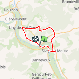
Trail Walking of 20 km to be discovered at Grand Est, Meuse, Vilosnes-Haraumont. This trail is proposed by AlainQuent.
Positioning
Country:
France
Region :
Grand Est
Department/Province :
Meuse
Municipality :
Vilosnes-Haraumont
Location:
Unknown
Start:(Dec)
Start:(UTM)
662329 ; 5466432 (31U) N.
Comments