Trail Walking Saint-Jean-aux-Bois - en forêt de Compiègne_29_les Tournantes sur la Héronnière et sur la Tête Saint-Jean - Photo

en forêt de Compiègne_29_les Tournantes sur la Héronnière et sur la Tête Saint-Jean

mes randos en forêt

© OpenStreetMap contributors
Length
Length
10.6 km
Max alt
Max alt
144 m
Uphill gradient
Uphill gradient
123 m
Km-Effort
Km-Effort  
12.3 km
Min alt
Min alt
106 m
Downhill gradient
Downhill gradient
122 m
Boucle
Boucle
Yes
Creation date :
2019-07-22 05:41:20.0
Updated on :
2022-09-13 16:19:19.199

(0 Reviews)

Walking
Walking
3h03
Difficulty : Medium

Scan this QR Code to open this trail in the SityTrail application

FREE GPS app for hiking

Logo SityTrail SityTrail

IGN / Geographical institutes

Download SityTrail from the App Store Download SityTrail from Google Play

Logo SityTrail SityTrail World

The world is yours!

Download SityTrail from the App Store Download SityTrail from Google Play Download SityTrail on Huawei AppGallery

About

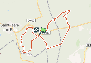
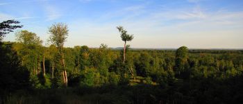
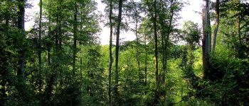
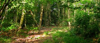
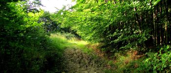
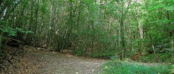
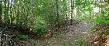
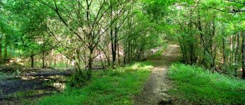
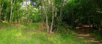
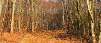
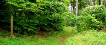
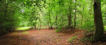
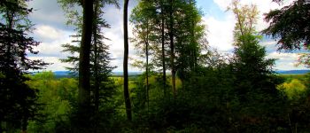
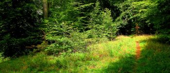
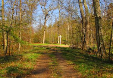
Trail Walking of 10.6 km to be discovered at Hauts-de-France, Oise, Saint-Jean-aux-Bois. This trail is proposed by en forêt de Compiègne.

Description

07/ 2019
voir aussi:
https://foret-de-compiegne.over-blog.com/2019/07/randonnee-en-foret-de-compiegne_les-tournantes-sur-la-heronnerie-et-sur-la-tete-saint-jean.html

batterie pour iphone de rechange pour iphone conseillée.

warning:  
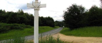
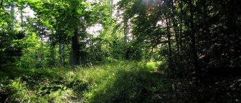
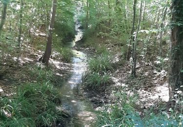
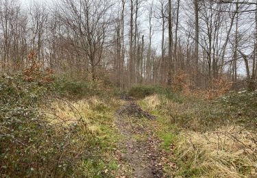
sur la Route Tournante de la Héronnerie,  au dessus du Ru de la Fontaine Porchers: carte IGN inexacte. Plus de chemin. J'ai préféré continuer sur la Route du Vivier Payen jusqu'au carrefour de la Fontaine aux Porchers. Voir mon gazouillis. Merci l'alarme sonore de sitytrail.
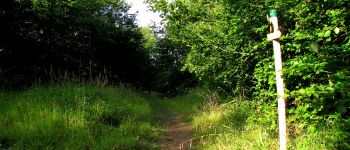
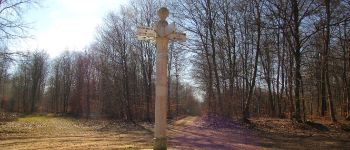
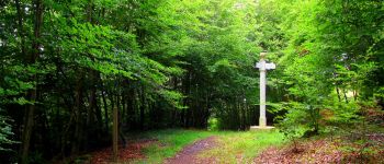
Le GR12 est sur une partie de la Tournante sur la Héronnerie (au départ).

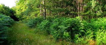
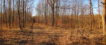
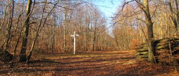
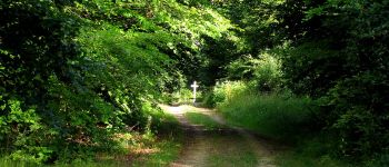
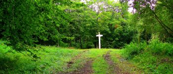
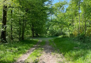
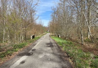
Au départ du carrefour Saint-Nicolas de Courson, suivre la Route Tournante sur la Héronnerie pour rejoindre le carrefour de la Fontaine aux Porchers. Traverser la D85 et suivre la Route de la Fontaine aux Porchers jusqu'au carrefour du Bois de Damart. Prendre à droite la Route d'Haucourt et la suivre jusqu'au carrefour du Change. Tourner à droite dans la Route de la Garenne du Roi et continuer jusqu'au carrefour des Gardes. Tourner à gauche dans la Route de l'Arc et rejoindre le carrefour de Saint-Nicolas de Courson (point de départ). Faire la Route Tournante sur la Tête Saint-Jean jusqu'à son extrémité, le carrefour de la Tête Saint-Jean. Prendre à droite la Route de la Tête Saint-Jean pour revenir au point de départ , le carrefour de Saint-Nicolas de Courson.

Elevation profile

Points of interest

Point of interest Saint-Jean-aux-Bois - Unnamed POI - Photo
JeanLucA4
SAINT-JEAN-AUX-BOIS 
Point of interest Saint-Jean-aux-Bois - Point 2 - Photo
JeanLucA4
SAINT-JEAN-AUX-BOIS 
Point of interest Saint-Jean-aux-Bois - Unnamed POI - Photo
JeanLucA4
SAINT-JEAN-AUX-BOIS 
Point of interest Saint-Jean-aux-Bois - Point 3 - Photo
JeanLucA4
SAINT-JEAN-AUX-BOIS 
Point of interest Pierrefonds - Unnamed POI - Photo
JeanLucA4
PIERREFONDS 
Point of interest Pierrefonds - Unnamed POI - Photo
JeanLucA4
PIERREFONDS 
Point of interest Pierrefonds - Point 4 - Photo
JeanLucA4
PIERREFONDS 
Point of interest Pierrefonds - Point 5 - Photo
JeanLucA4
PIERREFONDS 
Point of interest Pierrefonds - Point 6 - Photo
JeanLucA4
PIERREFONDS 
Point of interest Pierrefonds - Point 7 - Photo
JeanLucA4
PIERREFONDS 
Point of interest Pierrefonds - Point 8 - Photo
JeanLucA4
PIERREFONDS 
Point of interest Pierrefonds - Point 9 - Photo
JeanLucA4
PIERREFONDS 
Point of interest Pierrefonds - Point 10 - Photo
JeanLucA4
PIERREFONDS 
Point of interest Pierrefonds - Point 11 - Photo
JeanLucA4
PIERREFONDS 
Point of interest Pierrefonds - Point 11 - Photo
JeanLucA4
PIERREFONDS 
Point of interest Pierrefonds - Point 12 - Photo
JeanLucA4
PIERREFONDS 
Point of interest Pierrefonds - Point 34 - Photo
JeanLucA4
PIERREFONDS 
Point of interest Saint-Jean-aux-Bois - Point 15 - Photo
JeanLucA4
SAINT-JEAN-AUX-BOIS 
Point of interest Saint-Jean-aux-Bois - Point 14 - Photo
JeanLucA4
SAINT-JEAN-AUX-BOIS 
Point of interest Saint-Jean-aux-Bois - Point 13 - Photo
JeanLucA4
SAINT-JEAN-AUX-BOIS 
Point of interest Saint-Jean-aux-Bois - Point 16 - Photo
JeanLucA4
SAINT-JEAN-AUX-BOIS 
Point of interest Saint-Jean-aux-Bois - Point 17 - Photo
JeanLucA4
SAINT-JEAN-AUX-BOIS 
Point of interest Saint-Jean-aux-Bois - Unnamed POI - Photo
JeanLucA4
SAINT-JEAN-AUX-BOIS 
Point of interest Saint-Jean-aux-Bois - Unnamed POI - Photo
JeanLucA4
SAINT-JEAN-AUX-BOIS 
Point of interest Saint-Jean-aux-Bois - Unnamed POI - Photo
JeanLucA4
SAINT-JEAN-AUX-BOIS 
Point of interest Saint-Jean-aux-Bois - Unnamed POI - Photo
JeanLucA4
SAINT-JEAN-AUX-BOIS 
Point of interest Saint-Jean-aux-Bois - Unnamed POI - Photo
JeanLucA4
SAINT-JEAN-AUX-BOIS 
Point of interest Saint-Jean-aux-Bois - Unnamed POI - Photo
JeanLucA4
SAINT-JEAN-AUX-BOIS 
Point of interest Saint-Jean-aux-Bois - Point 18 - Photo
JeanLucA4
SAINT-JEAN-AUX-BOIS 
Point of interest Saint-Jean-aux-Bois - Point 19 - Photo
JeanLucA4
SAINT-JEAN-AUX-BOIS 
Point of interest Saint-Jean-aux-Bois - Point 20 - Photo
JeanLucA4
SAINT-JEAN-AUX-BOIS 
Point of interest Saint-Jean-aux-Bois - Unnamed POI - Photo
JeanLucA4
SAINT-JEAN-AUX-BOIS 

Positioning

Country:
France
Region :
Hauts-de-France
Department/Province :
Oise
Municipality :
Saint-Jean-aux-Bois
Location:
Unknown
Start:(UTM)
494573 ; 5465675 (31U) N.

Trails nearby

Trail On foot Pierrefonds - Le Voliard - Photo
On foot
PRO

On foot

Easy
(1)
Pierrefonds, Hauts-de-France, Oise, France
5.2 km | 6.4 km-effort
1h 27min
No
Trail On foot Saint-Jean-aux-Bois - Promenade du Chêne de Saint-Jean - Photo
On foot
PRO

On foot

Easy
Saint-Jean-aux-Bois, Hauts-de-France, Oise, France
5.7 km | 6.5 km-effort
1h 28min
No
Trail Walking Pierrefonds - Rando couscous ATPC ARVAL 4/2/2024 - Photo
Walking
pascha

Walking

Medium
(1)
Pierrefonds, Hauts-de-France, Oise, France
9.6 km | 11.9 km-effort
2h 42min
Yes
Trail Walking Saint-Jean-aux-Bois - SAINT JEAN AUX BOIS, le village et les bois - Photo
Walking
jeannine grandjean

Walking

Easy
Saint-Jean-aux-Bois, Hauts-de-France, Oise, France
4.6 km | 5.2 km-effort
1h 11min
Yes
Trail Walking Vieux-Moulin - Gorges du Han - ATPC ARVAL - Photo
Walking
pascha

Walking

Very easy
(1)
Vieux-Moulin, Hauts-de-France, Oise, France
13.2 km | 16 km-effort
2h 42min
Yes
Trail Walking Compiègne - en Forêt de Compiègne_50_les Routes des Beaux Monts, de Morpigny et des Nymphes - Photo
Walking

Walking

Very difficult
Compiègne, Hauts-de-France, Oise, France
17 km | 20 km-effort
5h 2min
Yes
Trail Walking Compiègne - en forêt de Compiègne_48_sur les Routes de la Mariolle et du Grand Veneur - Photo
Walking

Walking

Very difficult
Compiègne, Hauts-de-France, Oise, France
17 km | 19.9 km-effort
5h 21min
Yes
Trail Walking Saint-Jean-aux-Bois - Saint Jean au Bois 13,4 km - Photo
Walking
GUIDE
rvapeldo

Walking

Easy
Saint-Jean-aux-Bois, Hauts-de-France, Oise, France
13.4 km | 16.3 km-effort
3h 51min
Yes
Trail Walking Compiègne - en forêt de Compiègne_43_le Petit Octogone et vers la Faisanderie - Photo
Walking

Walking

Difficult
Compiègne, Hauts-de-France, Oise, France
13 km | 14.7 km-effort
4h 37min
Yes


Close
My subscriptions