Cirque de Chamaliere

togolo28
User

Length
12.9 km

Max alt
1446 m

Uphill gradient
482 m
Km-Effort
19.3 km

Min alt
1044 m

Downhill gradient
482 m
Boucle
Yes
Creation date :
2019-07-22 19:45:32.663
Updated on :
2019-07-29 11:31:21.609
4h01
Difficulty : Difficult

FREE GPS app for hiking
 SityTrail
IGN / Geographical institutes
SityTrail Plus
The world is yours!
About
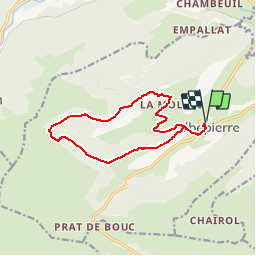
Trail Walking of 12.9 km to be discovered at Auvergne-Rhône-Alpes, Cantal, Albepierre-Bredons. This trail is proposed by togolo28.
Positioning
Country:
France
Region :
Auvergne-Rhône-Alpes
Department/Province :
Cantal
Municipality :
Albepierre-Bredons
Location:
Unknown
Start:(Dec)
Start:(UTM)
486823 ; 4991560 (31T) N.
Comments