Trail Walking Aumale - Le bois Robin - Aumale - Photo

Le bois Robin - Aumale

 tracegps
tracegps

User

© OpenStreetMap contributors
Length
Length
8.4 km
Max alt
Max alt
215 m
Uphill gradient
Uphill gradient
130 m
Km-Effort
Km-Effort  
10.1 km
Min alt
Min alt
119 m
Downhill gradient
Downhill gradient
130 m
Boucle
Boucle
Yes
Creation date :
2014-12-10 00:00:00.0
Updated on :
2014-12-10 00:00:00.0

(0 Reviews)

Walking
Walking
2h10
Difficulty : Easy

Scan this QR Code to open this trail in the SityTrail application

FREE GPS app for hiking

Logo SityTrail SityTrail

IGN / Geographical institutes

Download SityTrail from the App Store Download SityTrail from Google Play

Logo SityTrail SityTrail World

The world is yours!

Download SityTrail from the App Store Download SityTrail from Google Play Download SityTrail on Huawei AppGallery

About

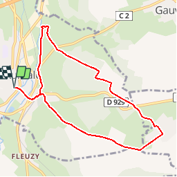
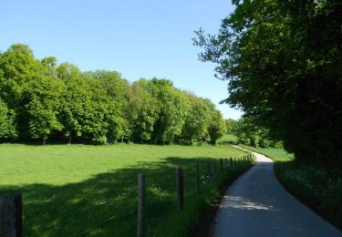
Trail Walking of 8.4 km to be discovered at Normandy, Seine-Maritime, Aumale. This trail is proposed by tracegps.

Description

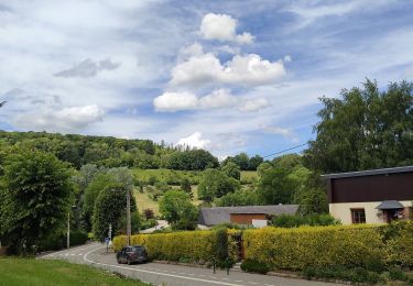
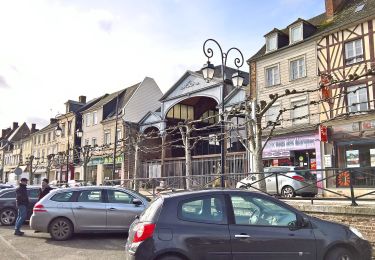
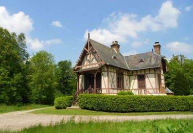
Le circuit au départ de l'Office du Tourisme d'Aumale, Rue René Gicquel, contourne le bois Robin en empruntant le GR de Pays de la Haute Forêt de Guimerville, traverse le village de Digeon pour rejoindre la chapelle du Cardonnoy après être passé à travers le bois de Gauville. Édifiée au 13e siècle en l'honneur de la vierge, la façade du flan méridional et la voûte de la chapelle sont restaurés au 17e siècle. On se dirige vers Aumale, pour le retour, en passant par le chemin des Longuignoles.

Elevation profile

Photos

Positioning

Country:
France
Region :
Normandy
Department/Province :
Seine-Maritime
Municipality :
Aumale
Location:
Unknown
Start:(UTM)
410166 ; 5513619 (31U) N.

Trails nearby

Trail On foot Marques - La Quesnoye - Photo
On foot
PRO

On foot

Easy
Marques, Normandy, Seine-Maritime, France
11.4 km | 14.5 km-effort
3h 17min
Yes
Trail On foot Aumale - Le Bois Robin - Photo
On foot
PRO

On foot

Easy
Aumale, Normandy, Seine-Maritime, France
7.2 km | 8.8 km-effort
1h 59min
Yes
Trail On foot Aumale - Le Beau Soleil - Photo
On foot
PRO

On foot

Easy
Aumale, Normandy, Seine-Maritime, France
9.8 km | 12.2 km-effort
2h 45min
Yes
Trail Equestrian Aumale - Le beau soleil N° 2 - Aumale  - Photo
Equestrian
tracegps

Equestrian

Medium
Aumale, Normandy, Seine-Maritime, France
10.8 km | 13.4 km-effort
2h 0min
Yes
Trail Mountain bike Aumale - Le beau soleil N° 2 - Aumale  - Photo
Mountain bike
tracegps

Mountain bike

Medium
Aumale, Normandy, Seine-Maritime, France
10.8 km | 13.4 km-effort
1h 0min
Yes
Trail Walking Aumale - Le beau soleil N° 2 - Aumale  - Photo
Walking
tracegps

Walking

Medium
Aumale, Normandy, Seine-Maritime, France
10.8 km | 13.4 km-effort
2h 40min
Yes
Trail Equestrian Haudricourt - La Lozière (N° 4)  - Haudricourt - Photo
Equestrian
tracegps

Equestrian

Medium
Haudricourt, Normandy, Seine-Maritime, France
11 km | 13.9 km-effort
1h 30min
Yes
Trail Mountain bike Haudricourt - La Lozière (N° 4)  - Haudricourt - Photo
Mountain bike
tracegps

Mountain bike

Easy
Haudricourt, Normandy, Seine-Maritime, France
11 km | 13.9 km-effort
1h 0min
Yes
Trail Walking Haudricourt - La Lozière (N° 4)  - Haudricourt - Photo
Walking
tracegps

Walking

Medium
Haudricourt, Normandy, Seine-Maritime, France
11 km | 13.9 km-effort
2h 45min
Yes


Close
My subscriptions