


1207459-track-1563980425-721

Renefrt
User
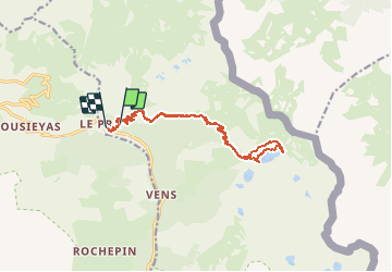

Length
17.4 km

Max alt
2439 m

Uphill gradient
915 m
Km-Effort
30 km

Min alt
1632 m

Downhill gradient
1035 m
Boucle
No
Creation date :
2019-07-24 15:00:16.0
Updated on :
2020-10-02 10:07:41.277
--
Difficulty : Difficult

FREE GPS app for hiking
 SityTrail
IGN / Geographical institutes
SityTrail Plus
The world is yours!
About
Trail On foot of 17.4 km to be discovered at Provence-Alpes-Côte d'Azur, Maritime Alps, Saint-Étienne-de-Tinée. This trail is proposed by Renefrt.
Positioning
Country:
France
Region :
Provence-Alpes-Côte d'Azur
Department/Province :
Maritime Alps
Municipality :
Saint-Étienne-de-Tinée
Location:
Unknown
Start:(Dec)
Start:(UTM)
331823 ; 4909862 (32T) N.
Comments