


arselle

Liebeaux
User
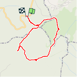

Length
4.5 km

Max alt
1639 m

Uphill gradient
103 m
Km-Effort
5.9 km

Min alt
1557 m

Downhill gradient
107 m
Boucle
Yes
Creation date :
2019-07-25 09:50:54.891
Updated on :
2019-07-25 12:11:37.195
2h20
Difficulty : Very easy

FREE GPS app for hiking
 SityTrail
IGN / Geographical institutes
SityTrail Plus
The world is yours!
About
Trail Walking of 4.5 km to be discovered at Auvergne-Rhône-Alpes, Isère, Vaulnaveys-le-Haut. This trail is proposed by Liebeaux.
Positioning
Country:
France
Region :
Auvergne-Rhône-Alpes
Department/Province :
Isère
Municipality :
Vaulnaveys-le-Haut
Location:
Unknown
Start:(Dec)
Start:(UTM)
725769 ; 4997958 (31T) N.
Comments