


Archiane, 4 chemins, Tussac

collot
User
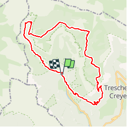

Length
18 km

Max alt
1783 m

Uphill gradient
1229 m
Km-Effort
34 km

Min alt
739 m

Downhill gradient
1238 m
Boucle
Yes
Creation date :
2019-07-25 14:40:47.534
Updated on :
2019-07-25 14:49:24.268
6h52
Difficulty : Very difficult

FREE GPS app for hiking
 SityTrail
IGN / Geographical institutes
SityTrail Plus
The world is yours!
About
Trail Walking of 18 km to be discovered at Auvergne-Rhône-Alpes, Drôme, Châtillon-en-Diois. This trail is proposed by collot.
Description
Belle randonnée.
Positioning
Country:
France
Region :
Auvergne-Rhône-Alpes
Department/Province :
Drôme
Municipality :
Châtillon-en-Diois
Location:
Treschenu-Creyers
Start:(Dec)
Start:(UTM)
698476 ; 4957729 (31T) N.
Comments