Trail Walking Argeliers - Le Pech de Bize - Argeliers - Photo

Le Pech de Bize - Argeliers

 tracegps
tracegps

User

© OpenStreetMap contributors
Length
Length
26 km
Max alt
Max alt
249 m
Uphill gradient
Uphill gradient
420 m
Km-Effort
Km-Effort  
32 km
Min alt
Min alt
40 m
Downhill gradient
Downhill gradient
419 m
Boucle
Boucle
Yes
Creation date :
2014-12-10 00:00:00.0
Updated on :
2014-12-10 00:00:00.0

(1 Reviews)

Walking
Walking
3h00
Difficulty : Medium

Scan this QR Code to open this trail in the SityTrail application

FREE GPS app for hiking

Logo SityTrail SityTrail

IGN / Geographical institutes

Download SityTrail from the App Store Download SityTrail from Google Play

Logo SityTrail SityTrail World

The world is yours!

Download SityTrail from the App Store Download SityTrail from Google Play Download SityTrail on Huawei AppGallery

About

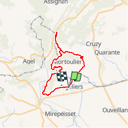
Trail Walking of 26 km to be discovered at Occitania, Aude, Argeliers. This trail is proposed by tracegps.

Description

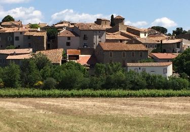
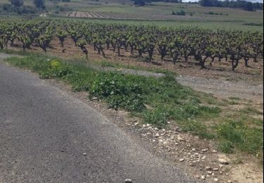
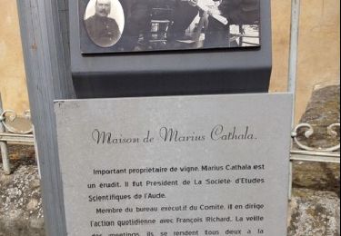
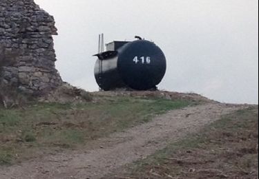
Au départ de l'église d'Argeliers, un circuit sympa au nord-ouest de la commune, le Pech de Bize. Trois premiers km à plat, puis on attaque le massif jusqu'au Cap Maurel. Au 11ème km, c'est le Mont Caramel. Au 17ème km, vous pourrez faire une pause tout près d'une maison de berger. Ensuite, c'est le retour sans effort et une belle descente vers Argeliers.

Elevation profile

Photos

Positioning

Country:
France
Region :
Occitania
Department/Province :
Aude
Municipality :
Argeliers
Location:
Unknown
Start:(UTM)
492599 ; 4795397 (31T) N.

Comments

Please log in to post a review or rate the element


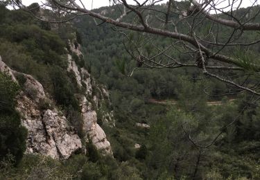
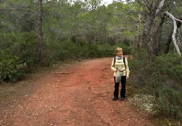
C'est une randonn?e qui ne pr?sente rien ? voir. La partie en sous-bois est agr?able. Pour le retour, il y a trop de goudron. Les 4 km (aller retour) partant sur la gauche n'apportent rien ? la randonn?e. Conclusion, c'est une randonn?e r?serv?e aux sportifs, les pistes sont tr?s larges o? l'on peut marcher tr?s vite.


Trails nearby

Trail Walking Cruzy - Cruzy, les défilés - Photo
Walking
SoleilMoussanais

Walking

Medium
(1)
Cruzy, Occitania, Hérault, France
9.4 km | 11.7 km-effort
2h 31min
Yes
Trail Walking Bize-Minervois - Montredon / Combebelle-le-haut - Photo
Walking
PiloudeBamako

Walking

Difficult
Bize-Minervois, Occitania, Aude, France
14.8 km | 20 km-effort
4h 50min
Yes
Trail Walking Montouliers - To Mont Redon - Photo
Walking
mootman

Walking

Very easy
Montouliers, Occitania, Hérault, France
5 km | 6.4 km-effort
1h 37min
Yes
Trail Walking Agel - Agel Forest - Photo
Walking
mootman

Walking

Easy
Agel, Occitania, Hérault, France
11.3 km | 14.1 km-effort
1h 56min
No
Trail Walking Cruzy - defiles de cruzy herault - Photo
Walking
Daron34

Walking

Very easy
Cruzy, Occitania, Hérault, France
9.1 km | 11.5 km-effort
3h 39min
Yes
Trail Walking Argeliers - ARGELIERS entre canal du Midi et vignes - Photo
Walking
marcheur75

Walking

Easy
Argeliers, Occitania, Aude, France
12.5 km | 14.1 km-effort
2h 25min
Yes
Trail Walking Argeliers - ARGELIERS vallèe de la Cesse.  - Photo
Walking
marcheur75

Walking

Very easy
Argeliers, Occitania, Aude, France
11.4 km | 12.2 km-effort
2h 10min
Yes
Trail Walking Argeliers - Argeliers  Les Canaux  - Photo
Walking
marcheur75

Walking

Very easy
Argeliers, Occitania, Aude, France
13 km | 14 km-effort
2h 18min
Yes
Trail Walking Argeliers - ARGELIERS Balade des Trois Citernes - Photo
Walking
marcheur75

Walking

Easy
Argeliers, Occitania, Aude, France
10.9 km | 15.2 km-effort
2h 8min
Yes


Close
My subscriptions