


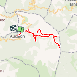
combe ala crête aucelon

Joel26400
User

Length
19 km

Max alt
1345 m

Uphill gradient
954 m
Km-Effort
32 km

Min alt
690 m

Downhill gradient
956 m
Boucle
Yes
Creation date :
2019-07-28 07:00:31.617
Updated on :
2019-07-29 07:08:45.117
6h15
Difficulty : Medium

FREE GPS app for hiking
 SityTrail
IGN / Geographical institutes
SityTrail Plus
The world is yours!
About
Trail Walking of 19 km to be discovered at Auvergne-Rhône-Alpes, Drôme, Aucelon. This trail is proposed by Joel26400.
Description
Pas terrible
Positioning
Country:
France
Region :
Auvergne-Rhône-Alpes
Department/Province :
Drôme
Municipality :
Aucelon
Location:
Unknown
Start:(Dec)
Start:(UTM)
686027 ; 4943908 (31T) N.
Comments