Trail Walking Échenevex - Sources de l''Allondon - Echenevex - Photo

Sources de l''Allondon - Echenevex

 tracegps
tracegps

User

© OpenStreetMap contributors
Length
Length
3.5 km
Max alt
Max alt
602 m
Uphill gradient
Uphill gradient
68 m
Km-Effort
Km-Effort  
4.4 km
Min alt
Min alt
538 m
Downhill gradient
Downhill gradient
68 m
Boucle
Boucle
Yes
Creation date :
2014-12-10 00:00:00.0
Updated on :
2014-12-10 00:00:00.0

(0 Reviews)

Walking
Walking
2h00
Difficulty : Medium

Scan this QR Code to open this trail in the SityTrail application

FREE GPS app for hiking

Logo SityTrail SityTrail

IGN / Geographical institutes

Download SityTrail from the App Store Download SityTrail from Google Play

Logo SityTrail SityTrail World

The world is yours!

Download SityTrail from the App Store Download SityTrail from Google Play Download SityTrail on Huawei AppGallery

About

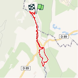
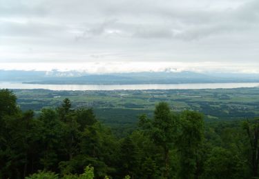
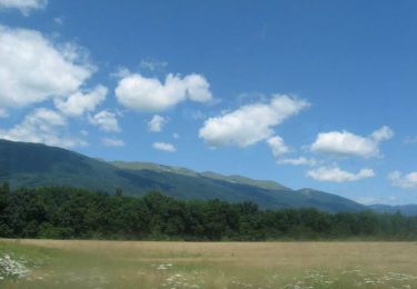
Trail Walking of 3.5 km to be discovered at Auvergne-Rhône-Alpes, Ain, Échenevex. This trail is proposed by tracegps.

Description

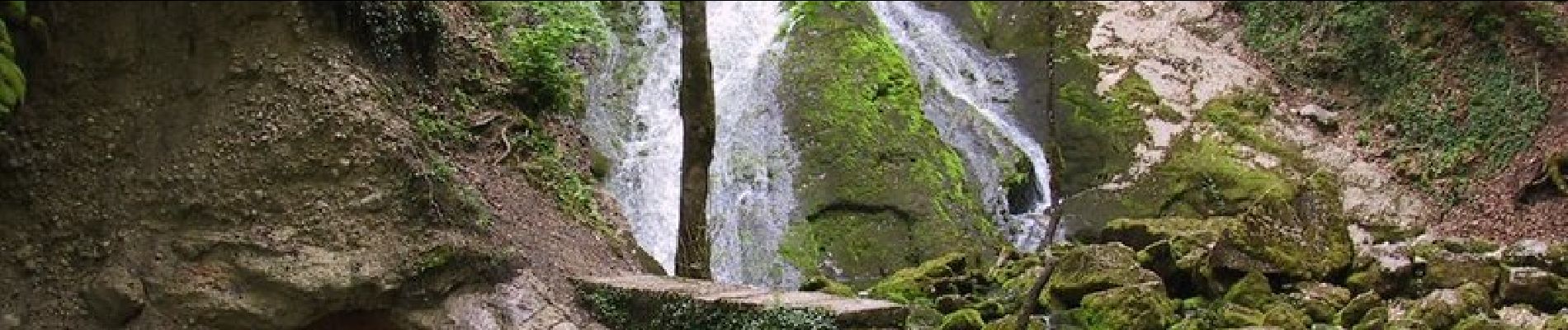
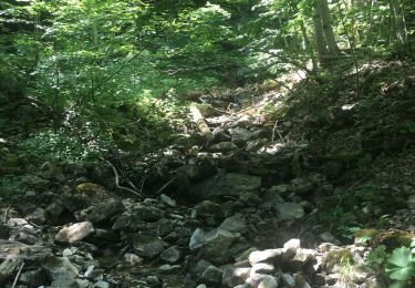
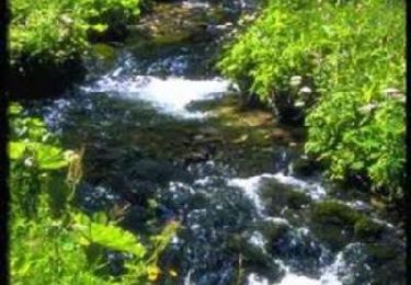
Superbe balade le long de la source de l'Allondon. Une fois arrivé au pont le chemin n'est plus entretenu, donc s'est plus technique mais la rivière sert de repère. Départ de la rue « Chemin de la source ».

Elevation profile

Photos

Positioning

Country:
France
Region :
Auvergne-Rhône-Alpes
Department/Province :
Ain
Municipality :
Échenevex
Location:
Unknown
Start:(UTM)
271150 ; 5131870 (32T) N.

Trails nearby

Trail Cycle Gex - Cyclo montagnarde : par les cols franco-suisse - Gex - Photo
Cycle
tracegps

Cycle

Difficult
Gex, Auvergne-Rhône-Alpes, Ain, France
61 km | 77 km-effort
4h 0min
Yes
Trail Cycle Gex - Les jardins de l'Europe - Version courte - Gex  - Photo
Cycle
tracegps

Cycle

Medium
Gex, Auvergne-Rhône-Alpes, Ain, France
34 km | 40 km-effort
2h 0min
Yes
Trail Cross-country skiing Gex - mont mourex - Photo
Cross-country skiing
rbonino

Cross-country skiing

Very easy
Gex, Auvergne-Rhône-Alpes, Ain, France
7 km | 9.5 km-effort
3h 48min
Yes
Trail Walking Gex - Rando Seblines - Photo
Walking
Romain Boubou

Walking

Medium
Gex, Auvergne-Rhône-Alpes, Ain, France
7 km | 10.2 km-effort
3h 6min
Yes
Trail Mountain bike Gex - Espace VTT FFC Entre Jura et Léman - Circuit n°63 - Les Druides - Photo
Mountain bike
tracegps

Mountain bike

Medium
Gex, Auvergne-Rhône-Alpes, Ain, France
10.3 km | 13.4 km-effort
1h 0min
Yes
Trail Walking Gex - GEX : le Mont Mourex - Photo
Walking
otgex

Walking

Very easy
(1)
Gex, Auvergne-Rhône-Alpes, Ain, France
9.6 km | 12.2 km-effort
3h 0min
Yes
Trail Walking Gex - Anaïs  - Photo
Walking
yucca77

Walking

Medium
(1)
Gex, Auvergne-Rhône-Alpes, Ain, France
7.1 km | 9.9 km-effort
2h 15min
No
Trail Walking Prévessin-Moëns - 01.01 Pregnin  - Photo
Walking
monique surace

Walking

Prévessin-Moëns, Auvergne-Rhône-Alpes, Ain, France
4.1 km | 4.6 km-effort
1h 3min
No
Trail Mountain bike Crozet - Crozet,télécabine du fierney - Photo
Mountain bike
Christophe.39

Mountain bike

Difficult
Crozet, Auvergne-Rhône-Alpes, Ain, France
7.3 km | 14 km-effort
1h 30min
No


Close
My subscriptions