


20190731

Yanitch
User
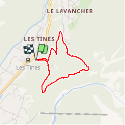

Length
3.2 km

Max alt
1336 m

Uphill gradient
228 m
Km-Effort
6.2 km

Min alt
1096 m

Downhill gradient
228 m
Boucle
Yes
Creation date :
2019-07-31 11:02:18.955
Updated on :
2019-07-31 13:17:02.98
1h14
Difficulty : Very easy

FREE GPS app for hiking
 SityTrail
IGN / Geographical institutes
SityTrail Plus
The world is yours!
About
Trail Walking of 3.2 km to be discovered at Auvergne-Rhône-Alpes, Upper Savoy, Chamonix-Mont-Blanc. This trail is proposed by Yanitch.
Positioning
Country:
France
Region :
Auvergne-Rhône-Alpes
Department/Province :
Upper Savoy
Municipality :
Chamonix-Mont-Blanc
Location:
Unknown
Start:(Dec)
Start:(UTM)
337294 ; 5090712 (32T) N.
Comments