


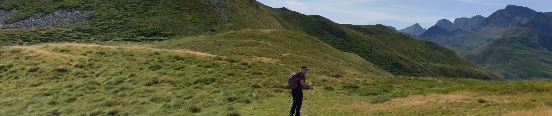
soum de mont

harydh
User GUIDE
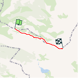

Length
2.7 km

Max alt
1975 m

Uphill gradient
302 m
Km-Effort
5.8 km

Min alt
1666 m

Downhill gradient
9 m
Boucle
No
Creation date :
2019-07-31 08:30:10.755
Updated on :
2019-07-31 12:48:14.268
1h02
Difficulty : Very easy

FREE GPS app for hiking
 SityTrail
IGN / Geographical institutes
SityTrail Plus
The world is yours!
About
Trail Walking of 2.7 km to be discovered at Occitania, Hautespyrenees, Beaucens. This trail is proposed by harydh.
Photos


Positioning
Country:
France
Region :
Occitania
Department/Province :
Hautespyrenees
Municipality :
Beaucens
Location:
Unknown
Start:(Dec)
Start:(UTM)
255870 ; 4761665 (31T) N.
Comments