


Pic Cassini

pb07
User
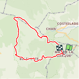

Length
16.8 km

Max alt
1678 m

Uphill gradient
402 m
Km-Effort
22 km

Min alt
1360 m

Downhill gradient
399 m
Boucle
Yes
Creation date :
2019-07-31 09:25:05.431
Updated on :
2019-07-31 20:34:47.2
5h43
Difficulty : Very easy

FREE GPS app for hiking
 SityTrail
IGN / Geographical institutes
SityTrail Plus
The world is yours!
About
Trail Walking of 16.8 km to be discovered at Occitania, Lozère, Vialas. This trail is proposed by pb07.
Positioning
Country:
France
Region :
Occitania
Department/Province :
Lozère
Municipality :
Vialas
Location:
Unknown
Start:(Dec)
Start:(UTM)
569770 ; 4915087 (31T) N.
Comments