


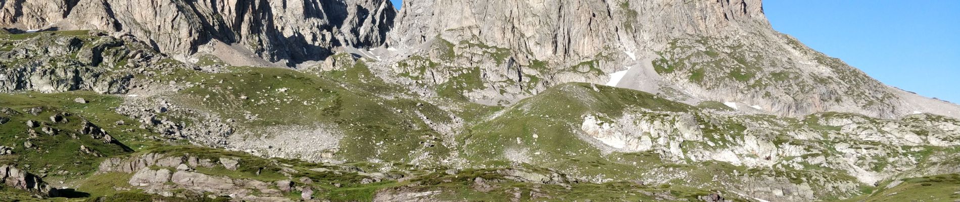
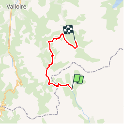
des Drayères à Terres rouges

reneperrin
User

Length
17.3 km

Max alt
2551 m

Uphill gradient
931 m
Km-Effort
30 km

Min alt
2041 m

Downhill gradient
937 m
Boucle
No
Creation date :
2019-07-31 05:43:42.496
Updated on :
2019-08-01 06:17:22.491
6h47
Difficulty : Medium

FREE GPS app for hiking
 SityTrail
IGN / Geographical institutes
SityTrail Plus
The world is yours!
About
Trail Walking of 17.3 km to be discovered at Provence-Alpes-Côte d'Azur, Hautes-Alpes, Névache. This trail is proposed by reneperrin.
Photos


30 photos in total. Please click on a photo to see them all in the gallery.
Positioning
Country:
France
Region :
Provence-Alpes-Côte d'Azur
Department/Province :
Hautes-Alpes
Municipality :
Névache
Location:
Unknown
Start:(Dec)
Start:(UTM)
303882 ; 4994965 (32T) N.
Comments