


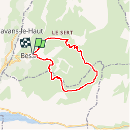
PLATEAU DES AMPARIS - BESSE - CHALET DE JOSSERAND - REFUGE DU FAY

jpb83
User

Length
13.3 km

Max alt
2314 m

Uphill gradient
842 m
Km-Effort
25 km

Min alt
1499 m

Downhill gradient
847 m
Boucle
Yes
Creation date :
2019-08-01 16:31:01.448
Updated on :
2019-08-01 16:49:00.354
6h45
Difficulty : Very difficult

FREE GPS app for hiking
 SityTrail
IGN / Geographical institutes
SityTrail Plus
The world is yours!
About
Trail Walking of 13.3 km to be discovered at Auvergne-Rhône-Alpes, Isère, Besse. This trail is proposed by jpb83.
Positioning
Country:
France
Region :
Auvergne-Rhône-Alpes
Department/Province :
Isère
Municipality :
Besse
Location:
Unknown
Start:(Dec)
Start:(UTM)
277440 ; 4994839 (32T) N.
Comments