


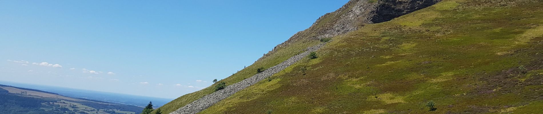
banne d'ordange

CHRIS jov
User
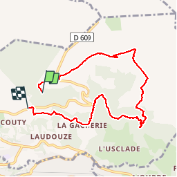

Length
8.5 km

Max alt
1466 m

Uphill gradient
339 m
Km-Effort
13.4 km

Min alt
1080 m

Downhill gradient
436 m
Boucle
No
Creation date :
2019-08-02 09:10:39.236
Updated on :
2019-08-02 13:58:57.285
3h38
Difficulty : Medium

FREE GPS app for hiking
 SityTrail
IGN / Geographical institutes
SityTrail Plus
The world is yours!
About
Trail Walking of 8.5 km to be discovered at Auvergne-Rhône-Alpes, Puy-de-Dôme, Murat-le-Quaire. This trail is proposed by CHRIS jov.
Photos

Positioning
Country:
France
Region :
Auvergne-Rhône-Alpes
Department/Province :
Puy-de-Dôme
Municipality :
Murat-le-Quaire
Location:
Unknown
Start:(Dec)
Start:(UTM)
480795 ; 5050205 (31T) N.
Comments