


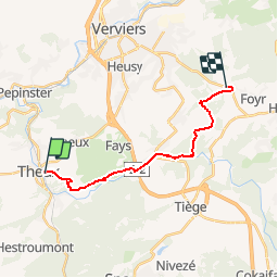
Theux Fouyr

Lychee
User

Length
15 km

Max alt
389 m

Uphill gradient
425 m
Km-Effort
20 km

Min alt
180 m

Downhill gradient
225 m
Boucle
No
Creation date :
2019-08-03 05:47:56.262
Updated on :
2019-08-03 05:53:17.071
4h21
Difficulty : Very difficult

FREE GPS app for hiking
 SityTrail
IGN / Geographical institutes
SityTrail Plus
The world is yours!
About
Trail Walking of 15 km to be discovered at Wallonia, Liège, Theux. This trail is proposed by Lychee.
Positioning
Country:
Belgium
Region :
Wallonia
Department/Province :
Liège
Municipality :
Theux
Location:
Theux
Start:(Dec)
Start:(UTM)
699636 ; 5601897 (31U) N.
Comments