


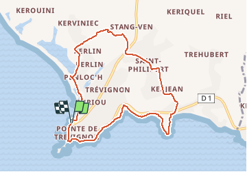
Boucle depuis la pointe de Trevignon

walrou63
User

Length
8.7 km

Max alt
24 m

Uphill gradient
60 m
Km-Effort
9.5 km

Min alt
1 m

Downhill gradient
58 m
Boucle
Yes
Creation date :
2019-08-04 07:44:31.371
Updated on :
2019-08-04 09:59:37.796
2h14
Difficulty : Very easy

FREE GPS app for hiking
 SityTrail
IGN / Geographical institutes
SityTrail Plus
The world is yours!
About
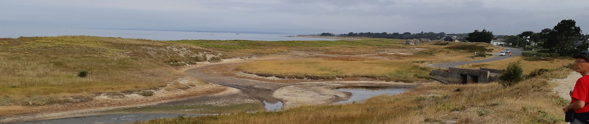
Trail Walking of 8.7 km to be discovered at Brittany, Finistère, Trégunc. This trail is proposed by walrou63.
Photos


Positioning
Country:
France
Region :
Brittany
Department/Province :
Finistère
Municipality :
Trégunc
Location:
Unknown
Start:(Dec)
Start:(UTM)
436195 ; 5293924 (30T) N.
Comments
Très belle rando. Côte et petits chemins. En revanche il ne fait pas bon être randonneur et camping-cariste par ici. Tout est interdit aux camping-car !