


Col d'Uzious

embarbe
User
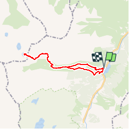

Length
13 km

Max alt
2239 m

Uphill gradient
1058 m
Km-Effort
27 km

Min alt
1214 m

Downhill gradient
1065 m
Boucle
Yes
Creation date :
2019-08-04 06:15:55.36
Updated on :
2019-08-05 07:45:04.781
6h57
Difficulty : Medium

FREE GPS app for hiking
 SityTrail
IGN / Geographical institutes
SityTrail Plus
The world is yours!
About
Trail Walking of 13 km to be discovered at Occitania, Hautespyrenees, Arrens-Marsous. This trail is proposed by embarbe.
Description
en boucle
Positioning
Country:
France
Region :
Occitania
Department/Province :
Hautespyrenees
Municipality :
Arrens-Marsous
Location:
Unknown
Start:(Dec)
Start:(UTM)
723786 ; 4754960 (30T) N.
Comments