


2019-08-05_07h07m41_2019-08-04_15h06m46_lacs-des-millefonts-040829

donda
User GUIDE
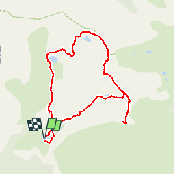


3h46
Difficulty : Difficult

FREE GPS app for hiking
 SityTrail
IGN / Geographical institutes
SityTrail Plus
The world is yours!
About
Trail Walking of 9.6 km to be discovered at Provence-Alpes-Côte d'Azur, Maritime Alps, Valdeblore. This trail is proposed by donda.
Description
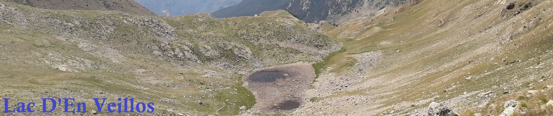
Parcours Lacs des Millefonts : Départ parking des Millefonts, col Veillos alt:2194m, lacs Petit, lac des Millefonts, lac Rond, lac Long, Lac Gros, col de Barn alt: 2451m, Mont Pépoiri alt: 2674m , Mont Pétoumier alt: 2604m, retour par le lac D'En Vellios
Photos


Positioning
Comments