


gonsans cascade de l'audeux ; reel fait le 6-3-2016

gerardmicheline
User
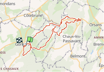

Length
21 km

Max alt
609 m

Uphill gradient
414 m
Km-Effort
26 km

Min alt
430 m

Downhill gradient
435 m
Boucle
No
Creation date :
2019-08-05 07:00:50.271
Updated on :
2019-08-05 07:00:50.271

FREE GPS app for hiking
 SityTrail
IGN / Geographical institutes
SityTrail Plus
The world is yours!
About
Trail of 21 km to be discovered at Bourgogne-Franche-Comté, Doubs, Gonsans. This trail is proposed by gerardmicheline.
Positioning
Country:
France
Region :
Bourgogne-Franche-Comté
Department/Province :
Doubs
Municipality :
Gonsans
Location:
Unknown
Start:(Dec)
Start:(UTM)
295972 ; 5234290 (32T) N.
Comments