Trail Walking Cournon-d'Auvergne - 
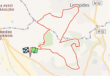
Cournon_Bane_Anzelle - Photo
 jagarnier
jagarnier

User GUIDE

© OpenStreetMap contributors
Length
Length
12.8 km
Max alt
Max alt
531 m
Uphill gradient
Uphill gradient
330 m
Km-Effort
Km-Effort  
17.2 km
Min alt
Min alt
353 m
Downhill gradient
Downhill gradient
330 m
Boucle
Boucle
Yes
Creation date :
2019-08-07 13:43:00.785
Updated on :
2025-04-10 10:55:04.643

(0 Reviews)

Walking
Walking
3h45
Difficulty : Medium

Scan this QR Code to open this trail in the SityTrail application

FREE GPS app for hiking

Logo SityTrail SityTrail

IGN / Geographical institutes

Download SityTrail from the App Store Download SityTrail from Google Play

Logo SityTrail SityTrail Plus

The world is yours!

Download SityTrail from the App Store Download SityTrail from Google Play Download SityTrail on Huawei AppGallery

About

Trail Walking of 12.8 km to be discovered at Auvergne-Rhône-Alpes, Puy-de-Dôme, Cournon-d'Auvergne. This trail is proposed by jagarnier.

Description

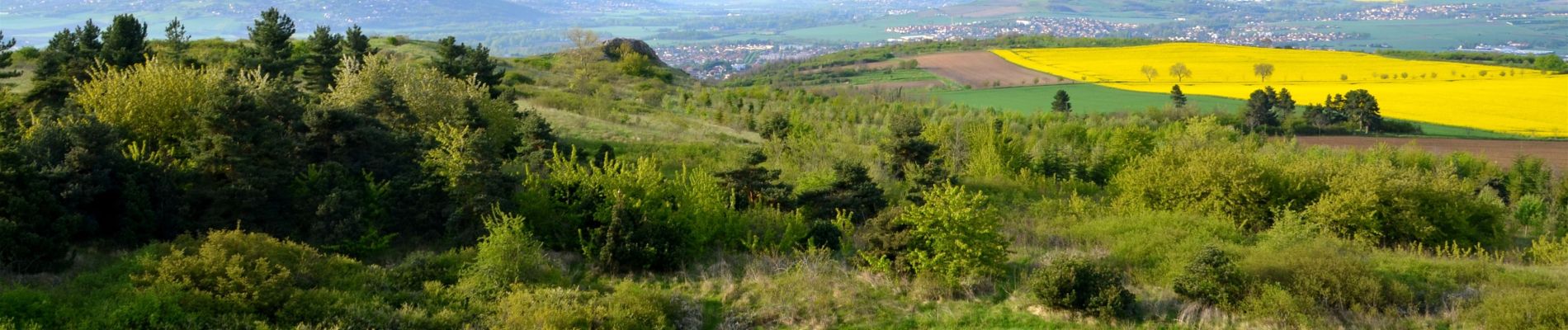
Entre Cournon et Lempdes, le puy d'Anzelle et le puy de Bane constituent une zone naturelle très riche. Autrefois couvert par les vignes, ils abritent plus de 250 espèces végétales et soixante espèces de papillons.

Elevation profile

Photos

Positioning

Country:
France
Region :
Auvergne-Rhône-Alpes
Department/Province :
Puy-de-Dôme
Municipality :
Cournon-d'Auvergne
Location:
Unknown
Start:(UTM)
513237 ; 5066115 (31T) N.


Close
My subscriptions