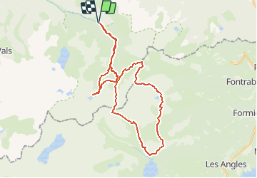
Trail Walking Orlu - Tour des Perics - Photo

Tour des Perics

© OpenStreetMap contributors
Length
Length
37 km
Max alt
Max alt
2608 m
Uphill gradient
Uphill gradient
2316 m
Km-Effort
Km-Effort  
68 km
Min alt
Min alt
1141 m
Downhill gradient
Downhill gradient
2319 m
Boucle
Boucle
Yes
Creation date :
2019-08-08 17:12:27.351
Updated on :
2019-08-08 23:26:19.135

(0 Reviews)

Walking
Walking
13h46
Difficulty : Very difficult

Scan this QR Code to open this trail in the SityTrail application

FREE GPS app for hiking

Logo SityTrail SityTrail

IGN / Geographical institutes

Download SityTrail from the App Store Download SityTrail from Google Play

Logo SityTrail SityTrail Plus

The world is yours!

Download SityTrail from the App Store Download SityTrail from Google Play Download SityTrail on Huawei AppGallery

About

Trail Walking of 37 km to be discovered at Occitania, Ariège, Orlu. This trail is proposed by petit-pied.

Elevation profile

Points of interest

Point of interest Angoustrine-Villeneuve-des-Escaldes - Bivouac 2 - Photo
petit-pied
ANGOUSTRINE-VILLENEUVE-DES-ESCALDES 
Point of interest Orlu - en beys - Photo
petit-pied
ORLU 
Point of interest Formiguères - Camporells - Photo
petit-pied
FORMIGUÈRES 

Positioning

Country:
France
Region :
Occitania
Department/Province :
Ariège
Municipality :
Orlu
Location:
Unknown
Start:(UTM)
413959 ; 4725633 (31T) N.


Close
My subscriptions