


9 florac-serre de la can

joelinou
User
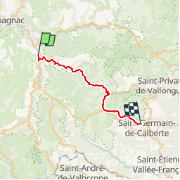

Length
29 km

Max alt
1032 m

Uphill gradient
857 m
Km-Effort
40 km

Min alt
546 m

Downhill gradient
636 m
Boucle
No
Creation date :
2019-08-08 18:10:00.153
Updated on :
2019-08-08 18:10:59.087
--
Difficulty : Difficult

FREE GPS app for hiking
 SityTrail
IGN / Geographical institutes
SityTrail Plus
The world is yours!
About
Trail On foot of 29 km to be discovered at Occitania, Lozère, Florac Trois Rivières. This trail is proposed by joelinou.
Description
GR70 STEVENSON
Positioning
Country:
France
Region :
Occitania
Department/Province :
Lozère
Municipality :
Florac Trois Rivières
Location:
Florac
Start:(Dec)
Start:(UTM)
547584 ; 4907698 (31T) N.
Comments