


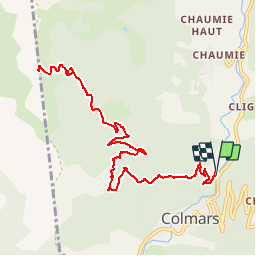
Colmars - L'Autapie

soca
User

Length
14.7 km

Max alt
2228 m

Uphill gradient
958 m
Km-Effort
27 km

Min alt
1282 m

Downhill gradient
960 m
Boucle
Yes
Creation date :
2019-08-11 12:57:32.092
Updated on :
2019-08-11 12:58:53.442
5h30
Difficulty : Very difficult

FREE GPS app for hiking
 SityTrail
IGN / Geographical institutes
SityTrail Plus
The world is yours!
About
Trail Walking of 14.7 km to be discovered at Provence-Alpes-Côte d'Azur, Alpes-de-Haute-Provence, Colmars. This trail is proposed by soca.
Positioning
Country:
France
Region :
Provence-Alpes-Côte d'Azur
Department/Province :
Alpes-de-Haute-Provence
Municipality :
Colmars
Location:
Unknown
Start:(Dec)
Start:(UTM)
310699 ; 4895373 (32T) N.
Comments