


Chasse - Le Gros Tapie

soca
User
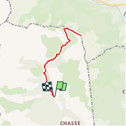

Length
13.4 km

Max alt
2355 m

Uphill gradient
879 m
Km-Effort
25 km

Min alt
1534 m

Downhill gradient
879 m
Boucle
Yes
Creation date :
2019-08-11 13:03:33.275
Updated on :
2019-08-12 15:51:55.83
5h02
Difficulty : Very difficult

FREE GPS app for hiking
 SityTrail
IGN / Geographical institutes
SityTrail Plus
The world is yours!
About
Trail Walking of 13.4 km to be discovered at Provence-Alpes-Côte d'Azur, Alpes-de-Haute-Provence, Villars-Colmars. This trail is proposed by soca.
Positioning
Country:
France
Region :
Provence-Alpes-Côte d'Azur
Department/Province :
Alpes-de-Haute-Provence
Municipality :
Villars-Colmars
Location:
Unknown
Start:(Dec)
Start:(UTM)
306283 ; 4896834 (32T) N.
Comments