


Gd Colombier col de la biche

mamirtine
User
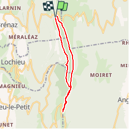

Length
11.1 km

Max alt
1512 m

Uphill gradient
525 m
Km-Effort
18.1 km

Min alt
1157 m

Downhill gradient
525 m
Boucle
Yes
Creation date :
2019-08-11 15:27:58.208
Updated on :
2019-08-11 15:29:10.524
3h42
Difficulty : Difficult

FREE GPS app for hiking
 SityTrail
IGN / Geographical institutes
SityTrail Plus
The world is yours!
About
Trail Walking of 11.1 km to be discovered at Auvergne-Rhône-Alpes, Ain, Arvière-en-Valromey. This trail is proposed by mamirtine.
Positioning
Country:
France
Region :
Auvergne-Rhône-Alpes
Department/Province :
Ain
Municipality :
Arvière-en-Valromey
Location:
Brénaz
Start:(Dec)
Start:(UTM)
713625 ; 5092313 (31T) N.
Comments