


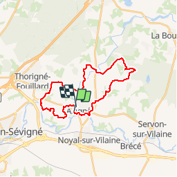
SityTrail - 02.09.2012 - ACIGNE

chasle
User

Length
27 km

Max alt
101 m

Uphill gradient
246 m
Km-Effort
30 km

Min alt
29 m

Downhill gradient
243 m
Boucle
No
Creation date :
2019-08-12 14:25:10.836
Updated on :
2019-08-12 14:25:10.836

FREE GPS app for hiking
 SityTrail
IGN / Geographical institutes
SityTrail Plus
The world is yours!
About
Trail of 27 km to be discovered at Brittany, Ille-et-Vilaine, Acigné. This trail is proposed by chasle.
Positioning
Country:
France
Region :
Brittany
Department/Province :
Ille-et-Vilaine
Municipality :
Acigné
Location:
Unknown
Start:(Dec)
Start:(UTM)
608781 ; 5332207 (30U) N.
Comments