


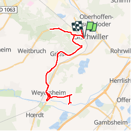
2019-08-12 Bischwiller

Bernardb44
User

Length
38 km

Max alt
155 m

Uphill gradient
268 m
Km-Effort
42 km

Min alt
124 m

Downhill gradient
267 m
Boucle
Yes
Creation date :
2019-08-12 15:30:00.041
Updated on :
2019-08-12 17:18:37.895
1h48
Difficulty : Easy

FREE GPS app for hiking
 SityTrail
IGN / Geographical institutes
SityTrail Plus
The world is yours!
About
Trail Road bike of 38 km to be discovered at Grand Est, Bas-Rhin, Bischwiller. This trail is proposed by Bernardb44.
Positioning
Country:
France
Region :
Grand Est
Department/Province :
Bas-Rhin
Municipality :
Bischwiller
Location:
Unknown
Start:(Dec)
Start:(UTM)
415539 ; 5402179 (32U) N.
Comments