


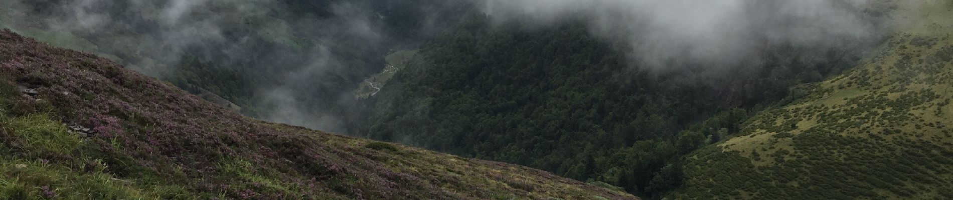
Lac d'Ourrec depuis Hautacam

611686735
User
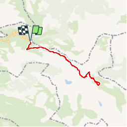

Length
13 km

Max alt
1879 m

Uphill gradient
531 m
Km-Effort
20 km

Min alt
1619 m

Downhill gradient
531 m
Boucle
Yes
Creation date :
2019-08-13 08:12:48.0
Updated on :
2019-08-14 22:30:34.16
4h15
Difficulty : Easy

FREE GPS app for hiking
 SityTrail
IGN / Geographical institutes
SityTrail Plus
The world is yours!
About
Trail Walking of 13 km to be discovered at Occitania, Hautespyrenees, Beaucens. This trail is proposed by 611686735.
Description
belle rando sympathique, réalisée par temps brumeux, dommage pour la vue. on surplombe le lac d'Isaby .
Photos


Positioning
Country:
France
Region :
Occitania
Department/Province :
Hautespyrenees
Municipality :
Beaucens
Location:
Unknown
Start:(Dec)
Start:(UTM)
744380 ; 4762056 (30T) N.
Comments
