


manigot boucle

dan69390
User
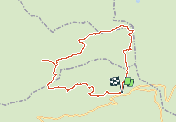

Length
10.1 km

Max alt
1696 m

Uphill gradient
376 m
Km-Effort
15.1 km

Min alt
1472 m

Downhill gradient
370 m
Boucle
Yes
Creation date :
2019-08-13 09:06:08.0
Updated on :
2019-08-13 14:20:51.029
3h44
Difficulty : Medium

FREE GPS app for hiking
 SityTrail
IGN / Geographical institutes
SityTrail Plus
The world is yours!
About
Trail Walking of 10.1 km to be discovered at Auvergne-Rhône-Alpes, Upper Savoy, Manigod. This trail is proposed by dan69390.
Positioning
Country:
France
Region :
Auvergne-Rhône-Alpes
Department/Province :
Upper Savoy
Municipality :
Manigod
Location:
Unknown
Start:(Dec)
Start:(UTM)
298498 ; 5083694 (32T) N.
Comments