


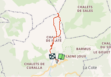
Contamines refuge de Platé Col Colonney Platiere

c.gourme
User

Length
15.1 km

Max alt
2482 m

Uphill gradient
1421 m
Km-Effort
34 km

Min alt
1174 m

Downhill gradient
1423 m
Boucle
Yes
Creation date :
2019-08-14 06:53:52.0
Updated on :
2020-09-13 12:06:11.303
6h27
Difficulty : Medium

FREE GPS app for hiking
 SityTrail
IGN / Geographical institutes
SityTrail Plus
The world is yours!
About
Trail Walking of 15.1 km to be discovered at Auvergne-Rhône-Alpes, Upper Savoy, Passy. This trail is proposed by c.gourme.
Positioning
Country:
France
Region :
Auvergne-Rhône-Alpes
Department/Province :
Upper Savoy
Municipality :
Passy
Location:
Unknown
Start:(Dec)
Start:(UTM)
323348 ; 5090547 (32T) N.
Comments