


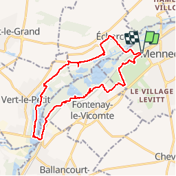
2019-08-14 Villeroy Vert le Petit 16 km

Lucquiaud
User

Length
16.5 km

Max alt
87 m

Uphill gradient
158 m
Km-Effort
18.5 km

Min alt
44 m

Downhill gradient
153 m
Boucle
Yes
Creation date :
2019-08-14 08:11:10.332
Updated on :
2019-08-14 14:11:54.66
5h59
Difficulty : Very easy

FREE GPS app for hiking
 SityTrail
IGN / Geographical institutes
SityTrail Plus
The world is yours!
About
Trail Walking of 16.5 km to be discovered at Ile-de-France, Essonne, Mennecy. This trail is proposed by Lucquiaud.
Positioning
Country:
France
Region :
Ile-de-France
Department/Province :
Essonne
Municipality :
Mennecy
Location:
Unknown
Start:(Dec)
Start:(UTM)
457558 ; 5379435 (31U) N.
Comments