


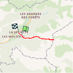
26 La Jarjatte col des aiguilles AR

HAL26
User

Length
8.4 km

Max alt
2023 m

Uphill gradient
778 m
Km-Effort
19 km

Min alt
1176 m

Downhill gradient
834 m
Boucle
No
Creation date :
2019-08-14 07:01:25.757
Updated on :
2019-08-14 16:20:50.372
3h39
Difficulty : Very easy

FREE GPS app for hiking
 SityTrail
IGN / Geographical institutes
SityTrail Plus
The world is yours!
About
Trail Walking of 8.4 km to be discovered at Auvergne-Rhône-Alpes, Drôme, Lus-la-Croix-Haute. This trail is proposed by HAL26.
Positioning
Country:
France
Region :
Auvergne-Rhône-Alpes
Department/Province :
Drôme
Municipality :
Lus-la-Croix-Haute
Location:
Unknown
Start:(Dec)
Start:(UTM)
718909 ; 4950335 (31T) N.
Comments