


Le Rocher de Soutron et sa chapelle 14/08/2019

Isabelle07
User

Length
11.4 km

Max alt
1107 m

Uphill gradient
530 m
Km-Effort
18.4 km

Min alt
607 m

Downhill gradient
523 m
Boucle
Yes
Creation date :
2019-08-14 08:28:34.225
Updated on :
2019-08-14 16:15:37.457
5h58
Difficulty : Medium

FREE GPS app for hiking
 SityTrail
IGN / Geographical institutes
SityTrail Plus
The world is yours!
About
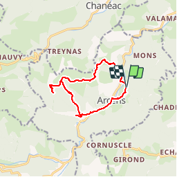
Trail Walking of 11.4 km to be discovered at Auvergne-Rhône-Alpes, Ardèche, Arcens. This trail is proposed by Isabelle07.
Positioning
Country:
France
Region :
Auvergne-Rhône-Alpes
Department/Province :
Ardèche
Municipality :
Arcens
Location:
Unknown
Start:(Dec)
Start:(UTM)
605018 ; 4973096 (31T) N.
Comments