Trail Walking Reinhardsmunster - 2019-08-15 Marche Schaerferplatz Geissfels Ochsenstein - Photo

2019-08-15 Marche Schaerferplatz Geissfels Ochsenstein

 holtzv
holtzv

User GUIDE

© OpenStreetMap contributors
Length
Length
15 km
Max alt
Max alt
612 m
Uphill gradient
Uphill gradient
622 m
Km-Effort
Km-Effort  
23 km
Min alt
Min alt
264 m
Downhill gradient
Downhill gradient
621 m
Boucle
Boucle
Yes
Creation date :
2019-08-14 20:02:30.809
Updated on :
2019-08-16 07:37:35.608

(0 Reviews)

Walking
Walking
4h49
Difficulty : Very difficult

Scan this QR Code to open this trail in the SityTrail application

FREE GPS app for hiking

Logo SityTrail SityTrail

IGN / Geographical institutes

Download SityTrail from the App Store Download SityTrail from Google Play

Logo SityTrail SityTrail Plus

The world is yours!

Download SityTrail from the App Store Download SityTrail from Google Play Download SityTrail on Huawei AppGallery

About

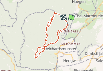
Trail Walking of 15 km to be discovered at Grand Est, Bas-Rhin, Reinhardsmunster. This trail is proposed by holtzv.

Description

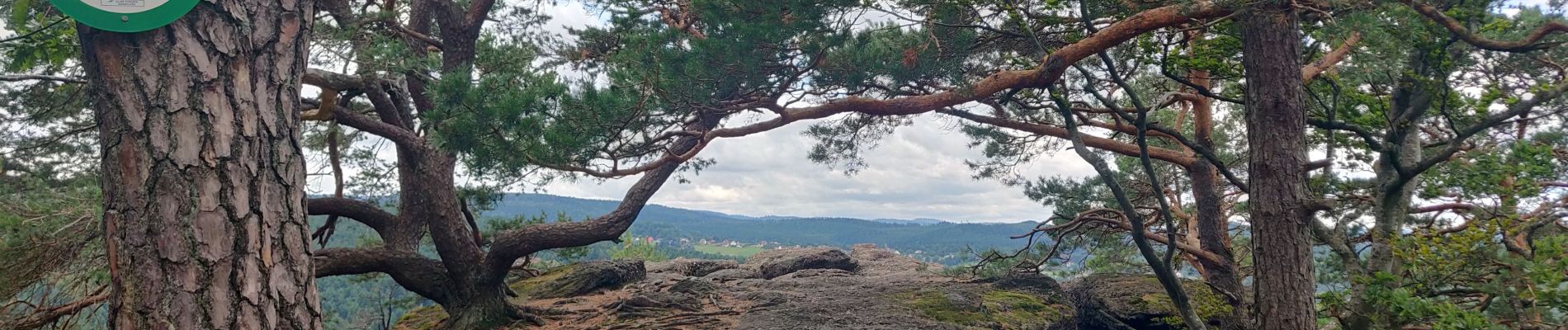
Marche depuis la M.F. du Schaeferthal en passant par le rocher du Hibou, le Geissfels, l'abri du Geissfelswasen, les M.F. Haberacker, le château l'Ochsenstein, le Schlossberg et le Wuestenberg et la pierre des druides.

Elevation profile

Photos

Positioning

Country:
France
Region :
Grand Est
Department/Province :
Bas-Rhin
Municipality :
Reinhardsmunster
Location:
Unknown
Start:(UTM)
376851 ; 5395072 (32U) N.


Close
My subscriptions