


Plateau des lacs, lac Fourchu. par bergerie

ezorzet
User
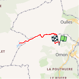

Length
12.8 km

Max alt
2104 m

Uphill gradient
774 m
Km-Effort
23 km

Min alt
1390 m

Downhill gradient
774 m
Boucle
Yes
Creation date :
2019-08-16 06:34:03.676
Updated on :
2019-08-17 00:27:26.948
6h22
Difficulty : Medium

FREE GPS app for hiking
 SityTrail
IGN / Geographical institutes
SityTrail Plus
The world is yours!
About
Trail Walking of 12.8 km to be discovered at Auvergne-Rhône-Alpes, Isère, Ornon. This trail is proposed by ezorzet.
Description
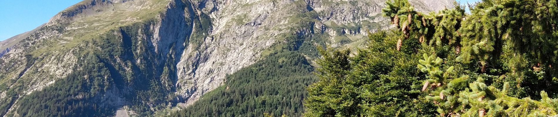
Magnifique randonnée
Photos


28 photos in total. Please click on a photo to see them all in the gallery.
Positioning
Country:
France
Region :
Auvergne-Rhône-Alpes
Department/Province :
Isère
Municipality :
Ornon
Location:
Unknown
Start:(Dec)
Start:(UTM)
734192 ; 4993411 (31T) N.
Comments