


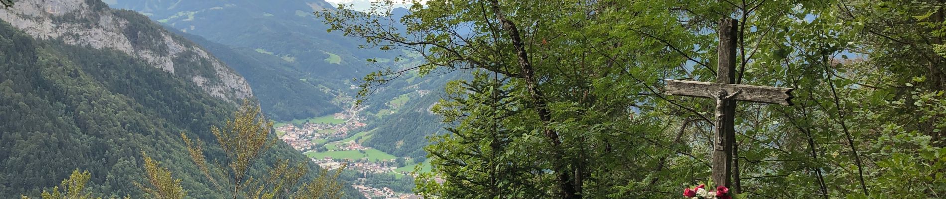
Les Glières depuis le Crêt

Chabard
User
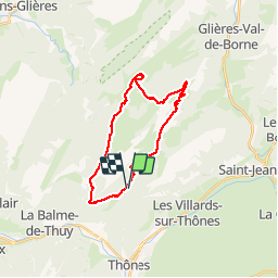

Length
24 km

Max alt
1813 m

Uphill gradient
1260 m
Km-Effort
41 km

Min alt
910 m

Downhill gradient
1255 m
Boucle
Yes
Creation date :
2019-08-15 05:15:44.0
Updated on :
2019-08-17 16:30:50.341
6h30
Difficulty : Unknown

FREE GPS app for hiking
 SityTrail
IGN / Geographical institutes
SityTrail Plus
The world is yours!
About
Trail Walking of 24 km to be discovered at Auvergne-Rhône-Alpes, Upper Savoy, Thônes. This trail is proposed by Chabard.
Description
La Tetaz, la Rosière, la maison du Plateau, le monument, la montagne des Auges, la Buffaz, le Crêt
Photos


Positioning
Country:
France
Region :
Auvergne-Rhône-Alpes
Department/Province :
Upper Savoy
Municipality :
Thônes
Location:
Unknown
Start:(Dec)
Start:(UTM)
292445 ; 5088213 (32T) N.
Comments