


SityTrail - chocolat

raymondfn
User

Length
7.5 km

Max alt
399 m

Uphill gradient
73 m
Km-Effort
8.4 km

Min alt
355 m

Downhill gradient
75 m
Boucle
Yes
Creation date :
2019-08-18 07:24:29.769
Updated on :
2023-02-04 19:21:24.88
1h06
Difficulty : Easy

FREE GPS app for hiking
 SityTrail
IGN / Geographical institutes
SityTrail Plus
The world is yours!
About
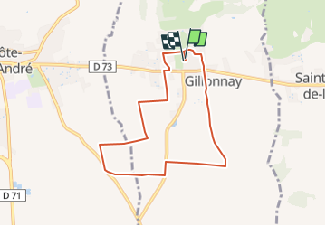
Trail Walking of 7.5 km to be discovered at Auvergne-Rhône-Alpes, Isère, Gillonnay. This trail is proposed by raymondfn.
Description
mgs
Positioning
Country:
France
Region :
Auvergne-Rhône-Alpes
Department/Province :
Isère
Municipality :
Gillonnay
Location:
Unknown
Start:(Dec)
Start:(UTM)
679738 ; 5029281 (31T) N.
Comments