


Rousset 1035m 20k

StephaneBM
User
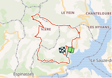

Length
22 km

Max alt
1551 m

Uphill gradient
949 m
Km-Effort
35 km

Min alt
804 m

Downhill gradient
950 m
Boucle
Yes
Creation date :
2019-08-18 11:37:34.043
Updated on :
2019-08-18 11:37:34.043
--
Difficulty : Unknown

FREE GPS app for hiking
 SityTrail
IGN / Geographical institutes
SityTrail Plus
The world is yours!
About
Trail Mountain bike of 22 km to be discovered at Provence-Alpes-Côte d'Azur, Hautes-Alpes, Rousset. This trail is proposed by StephaneBM.
Positioning
Country:
France
Region :
Provence-Alpes-Côte d'Azur
Department/Province :
Hautes-Alpes
Municipality :
Rousset
Location:
Unknown
Start:(Dec)
Start:(UTM)
282847 ; 4928934 (32T) N.
Comments