


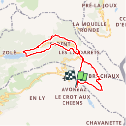
Avoriaz-les Lindarets-lac du Montriond

Francis057
User


5h31
Difficulty : Difficult

FREE GPS app for hiking
 SityTrail
IGN / Geographical institutes
SityTrail Plus
The world is yours!
About
Trail Walking of 15.7 km to be discovered at Auvergne-Rhône-Alpes, Upper Savoy, Morzine. This trail is proposed by Francis057.
Description
très belle marche, avec visite de la cascade des Brochaux et du hameau des Lindarets avec ses chèvres en liberté. une variante ici le retour des Lindarets se fait avec le télésiège jusqu'à Avoriaz...
Positioning
Comments