Trail Walking Gouaux-de-Larboust - cap des Hittes & Pic Monségu depuis Gouaux de Larboust - Photo

cap des Hittes & Pic Monségu depuis Gouaux de Larboust

 chrisgps
chrisgps

User

© OpenStreetMap contributors
Length
Length
9.5 km
Max alt
Max alt
2354 m
Uphill gradient
Uphill gradient
966 m
Km-Effort
Km-Effort  
22 km
Min alt
Min alt
1392 m
Downhill gradient
Downhill gradient
965 m
Boucle
Boucle
Yes
Creation date :
2019-08-17 11:06:31.527
Updated on :
2019-08-18 17:15:48.645

(0 Reviews)

Walking
Walking
6h06
Difficulty : Medium

Scan this QR Code to open this trail in the SityTrail application

FREE GPS app for hiking

Logo SityTrail SityTrail

IGN / Geographical institutes

Download SityTrail from the App Store Download SityTrail from Google Play

Logo SityTrail SityTrail World

The world is yours!

Download SityTrail from the App Store Download SityTrail from Google Play Download SityTrail on Huawei AppGallery

About

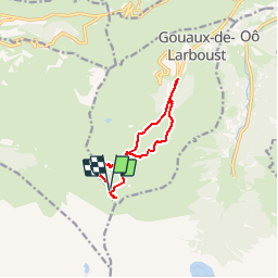
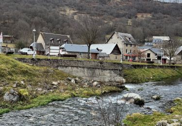
Trail Walking of 9.5 km to be discovered at Occitania, Haute-Garonne, Gouaux-de-Larboust. This trail is proposed by chrisgps.

Description

Départ du parking de la Vallée Blanche.
On remonte la piste jusqu'au 1er lacet et on continue dans le chemin qui grimpe vers un piton qui separe la vallée en 2 vallons. La montée sera faite  par celui de droite et la descente par celui de gauche (piste "vallée blanche").
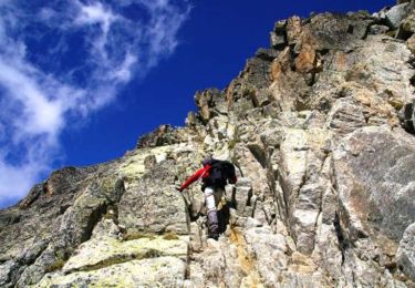
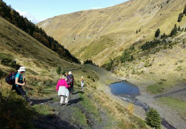
Passage à la cabane pastorale du Courtaou (ou Serre Doumengue?), neuve, fermée, avant de découvrir le laquet de Laouay. Montée par le vallon plein sud dans une combe formée par la Crête des Six Pics et celle du Monségu et du Cap des Hittes. Accès sur cette crête entre ces deux sommets. Beaux panoramas depuis les deux sommets notamment le val d'Esquirry depuis le Monségu.
Redescente d'abord en suivant la crête jusqu'à Pene Nère et  jusqu'au Laouay. Passage à la cabane Montmédan en suivant la piste de la "Vallée Blanche"jusqu'au parking.

Elevation profile

Photos

Positioning

Country:
France
Region :
Occitania
Department/Province :
Haute-Garonne
Municipality :
Gouaux-de-Larboust
Location:
Unknown
Start:(UTM)
292366 ; 4737407 (31T) N.

Trails nearby

Trail Walking Loudenvielle - Le refuge de la Soula - Photo
Walking
alainjoseph6

Walking

Difficult
(1)
Loudenvielle, Occitania, Hautespyrenees, France
13 km | 22 km-effort
5h 0min
Yes
Trail Walking Portet-de-Luchon - Du Col de Peyresourde au sommet du Pouyaué - Loudervielle - Photo
Walking
tracegps

Walking

Difficult
(1)
Portet-de-Luchon, Occitania, Haute-Garonne, France
9.9 km | 18.4 km-effort
4h 10min
Yes
Trail Walking Oô - Pic des Spijeoles - Photo
Walking
tracegps

Walking

Very difficult
(1)
Oô, Occitania, Haute-Garonne, France
17.4 km | 37 km-effort
14h 0min
No
Trail Walking Loudenvielle - Val d'Aube - Photo
Walking
zazibelle

Walking

Medium
(3)
Loudenvielle, Occitania, Hautespyrenees, France
11.1 km | 19.5 km-effort
4h 19min
Yes
Trail Walking Loudenvielle - Cabana d'ourtigas - Photo
Walking
Jeanne Pene

Walking

Very easy
(1)
Loudenvielle, Occitania, Hautespyrenees, France
14.2 km | 24 km-effort
6h 59min
Yes
Trail Walking Germ - GERM la cabane d Ourtiga G3 fait - Photo
Walking
GUIDE
marmotte65

Walking

Medium
Germ, Occitania, Hautespyrenees, France
10.6 km | 16.4 km-effort
5h 33min
Yes
Trail Snowshoes Germ - Germ raquettes le 27 Janvier 2018-fait - Photo
Snowshoes
GUIDE
marmotte65

Snowshoes

Medium
Germ, Occitania, Hautespyrenees, France
5.3 km | 9.1 km-effort
5h 7min
Yes
Trail Walking Oô - Seil de la Baque - Photo
Walking
ach31

Walking

Difficult
(1)
Oô, Occitania, Haute-Garonne, France
28 km | 56 km-effort
11h 9min
Yes
Trail Walking Gouaux-de-Larboust - Boucle autour d’Oô - Photo
Walking
nandaf

Walking

Gouaux-de-Larboust, Occitania, Haute-Garonne, France
9 km | 15.6 km-effort
3h 5min
Yes


Close
My subscriptions