


le courtet

Sylvie Mathiot
User
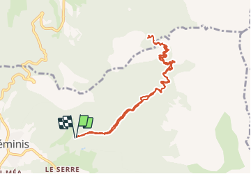

Length
10.3 km

Max alt
1717 m

Uphill gradient
696 m
Km-Effort
19.6 km

Min alt
1024 m

Downhill gradient
696 m
Boucle
Yes
Creation date :
2019-08-18 07:53:03.364
Updated on :
2019-08-19 12:14:04.446
4h33
Difficulty : Very easy

FREE GPS app for hiking
 SityTrail
IGN / Geographical institutes
SityTrail Plus
The world is yours!
About
Trail Walking of 10.3 km to be discovered at Auvergne-Rhône-Alpes, Isère, Tréminis. This trail is proposed by Sylvie Mathiot.
Photos


Positioning
Country:
France
Region :
Auvergne-Rhône-Alpes
Department/Province :
Isère
Municipality :
Tréminis
Location:
Unknown
Start:(Dec)
Start:(UTM)
720452 ; 4958702 (31T) N.
Comments