


Seine-port

robinier
User
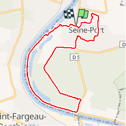

Length
9.6 km

Max alt
79 m

Uphill gradient
114 m
Km-Effort
11.1 km

Min alt
35 m

Downhill gradient
114 m
Boucle
Yes
Creation date :
2019-08-20 06:58:08.0
Updated on :
2019-08-20 09:52:07.669
2h51
Difficulty : Unknown

FREE GPS app for hiking
 SityTrail
IGN / Geographical institutes
SityTrail Plus
The world is yours!
About
Trail Walking of 9.6 km to be discovered at Ile-de-France, Seine-et-Marne, Seine-Port. This trail is proposed by robinier.
Positioning
Country:
France
Region :
Ile-de-France
Department/Province :
Seine-et-Marne
Municipality :
Seine-Port
Location:
Unknown
Start:(Dec)
Start:(UTM)
466638 ; 5378469 (31U) N.
Comments