


Moutiers au Perche 06.82

togolo28
User

Length
6.9 km

Max alt
208 m

Uphill gradient
131 m
Km-Effort
8.7 km

Min alt
158 m

Downhill gradient
135 m
Boucle
Yes
Creation date :
2014-12-10 00:00:00.0
Updated on :
2020-02-22 13:29:38.791
1h51
Difficulty : Easy

FREE GPS app for hiking
 SityTrail
IGN / Geographical institutes
SityTrail Plus
The world is yours!
About
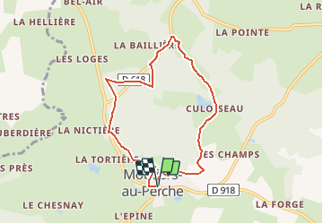
Trail Walking of 6.9 km to be discovered at Normandy, Orne, Moutiers-au-Perche. This trail is proposed by togolo28.
Positioning
Country:
France
Region :
Normandy
Department/Province :
Orne
Municipality :
Moutiers-au-Perche
Location:
Unknown
Start:(Dec)
Start:(UTM)
340868 ; 5371485 (31U) N.
Comments