


Lac de Matemale

richardsimopons
User
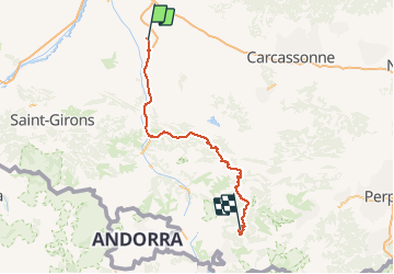

Length
148 km

Max alt
1581 m

Uphill gradient
3282 m
Km-Effort
188 km

Min alt
222 m

Downhill gradient
1965 m
Boucle
No
Creation date :
2019-08-21 17:31:44.0
Updated on :
2019-08-22 11:03:29.227
17h25
Difficulty : Unknown

FREE GPS app for hiking
 SityTrail
IGN / Geographical institutes
SityTrail Plus
The world is yours!
About
Trail Walking of 148 km to be discovered at Occitania, Haute-Garonne, Calmont. This trail is proposed by richardsimopons.
Description
Le tour du lac mais zones pastorales empêchent d’ être toujours au bord du lac. Il y a mieux à faire dans la région. Chiffre distance erroné!
Photos


Positioning
Country:
France
Region :
Occitania
Department/Province :
Haute-Garonne
Municipality :
Calmont
Location:
Unknown
Start:(Dec)
Start:(UTM)
388716 ; 4792483 (31T) N.
Comments