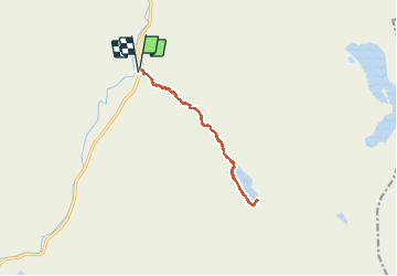
Trail Walking Avalanche Creek - Avalanche Lake - Photo
 GOHIER
GOHIER

User

© OpenStreetMap contributors
Length
Length
10.4 km
Max alt
Max alt
1239 m
Uphill gradient
Uphill gradient
302 m
Km-Effort
Km-Effort  
14.5 km
Min alt
Min alt
1040 m
Downhill gradient
Downhill gradient
304 m
Boucle
Boucle
Yes
Creation date :
2019-08-21 21:11:28.0
Updated on :
2019-08-22 16:50:38.458

(0 Reviews)

Walking
Walking
3h56
Difficulty : Unknown

Scan this QR Code to open this trail in the SityTrail application

FREE GPS app for hiking

Logo SityTrail SityTrail

IGN / Geographical institutes

Download SityTrail from the App Store Download SityTrail from Google Play

Logo SityTrail SityTrail World

The world is yours!

Download SityTrail from the App Store Download SityTrail from Google Play Download SityTrail on Huawei AppGallery

About

Trail Walking of 10.4 km to be discovered at Montana, Flathead County. This trail is proposed by GOHIER.

Description

Tout en forêt et heureusement à cause de la chaleur!  Observé ours noir adulte de bonne taille pendant une bonne demi-heure. Il a fallu s’éloigner rapidement car il venait vers nous à moins de 70 mètres!!!
Plusieurs très beaux deers aussi, à 10 m.
Superbe balade.

Elevation profile

Positioning

Country:
United States
Region :
Montana
Department/Province :
Flathead County
Municipality :
Avalanche Creek
Location:
Unknown
Start:(UTM)
292444 ; 5395649 (12U) N.

Trails nearby


Close
My subscriptions