


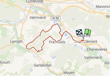
VTT Xermaménil via Les abouts 23/08/19

vathi54
User

Length
32 km

Max alt
299 m

Uphill gradient
309 m
Km-Effort
36 km

Min alt
225 m

Downhill gradient
309 m
Boucle
Yes
Creation date :
2019-08-23 14:37:31.317
Updated on :
2019-08-23 20:22:04.194
2h36
Difficulty : Easy

FREE GPS app for hiking
 SityTrail
IGN / Geographical institutes
SityTrail Plus
The world is yours!
About
Trail Mountain bike of 32 km to be discovered at Grand Est, Meurthe-et-Moselle, Saint-Clément. This trail is proposed by vathi54.
Description
Rando avec Maxime et Fabrice
Photos


Positioning
Country:
France
Region :
Grand Est
Department/Province :
Meurthe-et-Moselle
Municipality :
Saint-Clément
Location:
Unknown
Start:(Dec)
Start:(UTM)
323009 ; 5378518 (32U) N.
Comments