


2019-08-23_19h54m53_8387466-track-1565800833-419

Renefrt
User
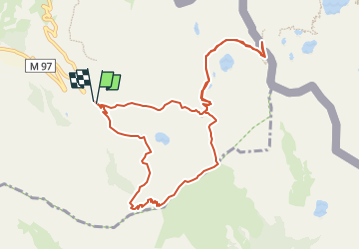

Length
11.1 km

Max alt
2621 m

Uphill gradient
688 m
Km-Effort
20 km

Min alt
2083 m

Downhill gradient
691 m
Boucle
Yes
Creation date :
2019-08-23 17:54:53.589
Updated on :
2023-02-06 19:21:13.411
4h36
Difficulty : Difficult

FREE GPS app for hiking
 SityTrail
IGN / Geographical institutes
SityTrail Plus
The world is yours!
About
Trail Walking of 11.1 km to be discovered at Provence-Alpes-Côte d'Azur, Maritime Alps, Isola. This trail is proposed by Renefrt.
Positioning
Country:
France
Region :
Provence-Alpes-Côte d'Azur
Department/Province :
Maritime Alps
Municipality :
Isola
Location:
Unknown
Start:(Dec)
Start:(UTM)
353209 ; 4894054 (32T) N.
Comments