


Pic du Tourmalet total

mitch1952
User
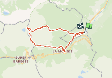

Length
16.2 km

Max alt
2463 m

Uphill gradient
1282 m
Km-Effort
33 km

Min alt
1218 m

Downhill gradient
1282 m
Boucle
Yes
Creation date :
2019-08-25 11:39:00.116
Updated on :
2022-06-01 19:13:10.442
6h36
Difficulty : Very difficult

FREE GPS app for hiking
 SityTrail
IGN / Geographical institutes
SityTrail Plus
The world is yours!
About
Trail Walking of 16.2 km to be discovered at Occitania, Hautespyrenees, Campan. This trail is proposed by mitch1952.
Positioning
Country:
France
Region :
Occitania
Department/Province :
Hautespyrenees
Municipality :
Campan
Location:
Unknown
Start:(Dec)
Start:(UTM)
271691 ; 4756490 (31T) N.
Comments